Case Study: How Horry County, SC, Used Drones to Increase ROI
The City of Myrtle Beach is the picturesque hub of what’s become known as the “Grand Strand” — a 60-mile string of beaches that runs along the South Carolina coastline. It’s a spectacular location, one famous for gorgeous, mile-long views along the beach.
But trust Tim Oliver: The view is much better from above. “I have a drone at home and my son also has one,” a grinning Oliver said. “I also get to fly a drone at work. Yeah, it’s really cool.”
Myrtle Beach is the largest city in Horry County, South Carolina, where Oliver is the director of IT/GIS. The county covers more square miles than the state of Rhode Island and its population of 290,000 swells to more than 2.5 million during the tourist-heavy summer months. It’s also one of the fastest-growing counties throughout the entire nation.
The constant growth is, of course, great for the local economy. New businesses are constantly popping up throughout the coastal cities that make up the Grand Strand. Oliver and his team lean on drone technology to make sure the county’s infrastructure remains intact and able to handle the rapid growth.
One example of this: the measurement of impervious surface data used to calculate stormwater fees. When it rains in Horry County (a regular occurrence), rainwater runs off buildings and onto any number of surfaces. Grass, trees, plants, and other organic surfaces absorb the water, while other surfaces — like parking lots — are “impervious,” meaning there’s nowhere for that water to be reabsorbed. Counties can collect fees for this “wasted” stormwater, allowing them to help fund the maintenance of the stormwater infrastructure.
A Missed Opportunity
Sounds great, right? It can be, but when these impervious surfaces aren’t measured regularly, a lot of fees go uncollected. That’s money “down the drain,” so to speak.
“Before we acquired drones, our collection process was every three to four years,” Oliver said. “We’d have a county-wide aerial imaging project in which we would gather impervious surface data, which we then used to calculate stormwater fees for the county.
“Because we flew every few years, if a structure or project was built right after that flight, it wasn’t captured until the next flight. So there could be three or four years that a commercial structure exists and functions, but is not billed for stormwater fees,” Oliver explained.
According to Oliver, if the economy dipped, the gap between flights would increase, meaning more stormwater fees would go uncollected even longer. But with modern technology, that’s all changed.

Drones Yield Increased Fee Collection
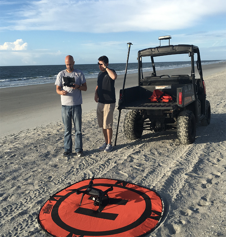
Here’s how the new system works: Horry County’s software sends out a notice as soon as a final inspection is requested on a new project. The notice is sent to the GIS team, which then sends out a drone to capture the impervious surface area, which is then used to calculate stormwater runoff. Fees are assigned to each new property, allowing Horry County to begin collecting fees as soon as a new project is completed.
What we’re doing now is flying all those new commercial projects at the time our software tells us that a final inspection has been requested on a building. We have a work order system in place that when that final inspection is requested, it kicks off a work order to our staff to fly the drone instead of waiting every few years.
Tim Oliver
Director of IT/GIS
The result is a huge increase in collected fees.
“Depending on the level of commercial development, we anticipate a $300,000 ROI over a three-year period because of the stormwater fees that we capture on the first billing, second billing, and third billing, rather than waiting until the fourth billing,” he said.
Data Collection Helps with Damage Assessments, Beach Erosion, and Citizen Safety
While streamlining the collection process and boosting county revenue is great, Horry County also uses technology to help with damage assessments and emergency requests for their citizens.
I think the power of the drone is not so much in the imagery and what you can see, but it’s once you bring it back and process that data. You can begin to capture the data of all the houses impacted by a storm, or look at the hill shade or the loss of a dune. That’s really the power behind the drone. It becomes the tool to allow you to use all the post-process power of technology.
Tim Oliver
Director of IT/GIS
One of the ways Horry County puts that technology to use is by using drones to conduct damage assessments and beach erosion after storms. Major storms — especially hurricanes and tropical storms — negatively impact beaches and can eventually impact the very-important tourism industry. By flying the beaches and collecting imagery, Horry County can create hill shades and extract contours using ArcGIS technology from Esri®. This allows the county to measure erosion and document loss, which, in turn, allows Horry County to request federal funding for beach re-nourishment.
In addition to protecting their beaches, Oliver’s goal is to put the power of technology into the hands of Horry County citizens.
“Creating interfaces that allow our citizens to request inspections in case of an emergency through self-service portals, or to let citizens provide information that helps us from a damage assessment perspective also helps us know where to send our teams out,” he said. “The drone helps us collect data, but it’s the back-office software that lets us know what to do with it.”
3-D Modeling Helps First Responders
Horry County also plans on using GIS and drone technology to empower the first responders responsible for acting on citizen help requests.
“We’re working on a process to create a 3-D image of critical facilities, whether they be county buildings, hospitals, fire stations, or schools,” Oliver explained. “Being able to fly the drones and use the drone technology gives us the ability to build the 3-D images of it. The value of that for first responders is this: Let’s say a hospital or a high-rise has changed in the past six months to a year because of additions or remodeling, which happens all the time. The entrance a first responder may have previously known about may have moved. So, first responders need to know where each of those entrances and exit points for facilities are. Not just a 2-D version of it, but to be able to see the real 3-D effect of it. So, we have a project list of buildings we’re going to be flying to create a 3-D model of those to be able to provide that tofirst responders.”
Ideally, this would allow first responders to access 3-D images on a tablet en route to an emergency, thus equipping them with better knowledge of entrances, exits, obstacles, and more. The functionality allows first responders to increase efficiency while staying safe in the field.
“The ability to provide 3-D images allows all first responders — including those not familiar with the building — to be on the same page,” Oliver said.
Drones Increase Awareness and Transparency
The beauty of drone technology is that it can be applied to a wide variety of projects. Oliver and his team are open to using their drones when they see an opportunity to add value to a project.
Horry County construction projects are a great example. Many citizens become frustrated with the inconvenience of road construction, and it doesn’t help that they don’t have any insight into what the finished project will accomplish or how their tax dollars are being spent. Oliver and his team hope to change that.

Being able to fly some of these road projects in various stages allows us to show citizens what’s being done. A drone flight allows us to post images on our sites to show where construction projects are at and the progress being made. When you see it from the air, you really get to see the total progress of projects, and people can get an idea of what the end product will look like. They can see what it will look like and what their tax dollars are accomplishing.
Tim Oliver
Director of IT/GIS
Conclusion
While Horry County has reaped a bounty of benefits from the power of drones, Oliver believes the ability to illustrate stories through GIS technology can empower local governments everywhere.
“I’ve always been a firm believer in show-and-tell. It’s always easier to show somebody what you’re trying to say, because when they see it, they all get that ‘AHA!’ moment,” Oliver said. “As technology professionals, our role is to provide the people we work for with the ‘AHA!’ moment, so they can improve their role along with the services that they offer to customers and citizens.”