Dispatchers Use Tech to Patrol Lake
August 13, 2019 by Anonym
Patrolling a lake is not without its challenges. For law enforcement officials tasked with patrolling Lake St. Clair in Michigan, they have numerous factors to consider.
The 430-square-mile lake is situated between the Canadian province of Ontario and the state of Michigan, which means government agencies for both countries provide law enforcement services for the lake. It also connects Lake Huron and Lake Erie via the St. Clair River and Detroit River, and has a deep shipping channel that brings commercial ships through on a regular basis.
Lake St. Clair is also a popular location for recreational activities throughout the year for watersports, ice fishing, and swimming. Numerous boat clubs, docks, and public beaches line the lake, which brings a vast amount of traffic to the area.
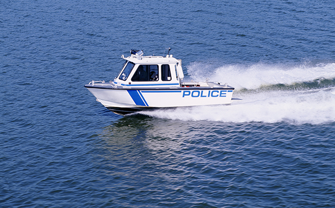
With such a high level of recreational and commercial activity on the lake, dispatchers and first responders with the Macomb County Sheriff’s Office in Michigan work diligently to keep the area safe.
The MCSO is responsible for 85 square miles of the lake, which includes more than thirty miles of shoreline, 57 miles of streams and rivers, and one mile of an international border with Canada.
The marine division’s responsibilities include enforcing and investigating marine, environmental, and criminal law on the lake, and inspecting boat rental operations and liveries. In addition, the MCSO marine division is the only agency on the lake equipped for fire suppression and patrol boats are equipped with fire pumps.
Even with all of these responsibilities, there was a time when MCSO dispatchers had no mapping capabilities to apply to the lake, so when marine law enforcement officers were dispatched to a call for service, they had no ability to immediately navigate to a specific location.
“We used to blindly dispatch to the lake,” communications supervisor with the MCSO Angela Elsey said. “We couldn’t use locations with any real coordinates or provide a geo-verified address because it was a body of water. Law enforcement still patrolled the lake, but they weren’t always as well-equipped with information.”
However, with the use of automatic vehicle location (AVL) functionality in the MCSO’s computer-aided dispatch (CAD) solution, blindly dispatching is a thing of the past.
According to Elsey, to see where patrol boats are located on the lake, dispatch receives the latitude and longitude of all boats. In addition, dispatchers can communicate with officers to let them know the distance between where they are and where they need to be in nautical miles.
“We need the same tools to patrol the lake as we do for any other area,” Elsey said. “We have all of the same issues on a lake as we do on land – which includes fights, drug activity, domestic abuse, and accidents - and that means we need to be ready for them.”
In the summer season, officers routinely patrol for incidences of drunk driving, drug use, reckless behavior, and disobeying marine laws. But they also have responded to emergencies involving capsized vessels, drownings, and lost voyagers.
During the cold winter months, the lake freezes and becomes a hot-spot for ice fishing, snow mobiles, and other winter activities.
“With a lake of that size, it’s important that we provide effective coverage in all areas,” Elsey said. “Being able to see where units are located makes it possible for dispatchers and first responders to know where everyone is located at all times. This helps us to send the best response possible and communicate when and where officers will arrive. In situations like a water rescue or other critical event, it’s paramount to know when help will arrive, and we can provide that service to those on the lake.”