What Tree Data Tells Us About Cities
September 30, 2019 by Melissa Crowe
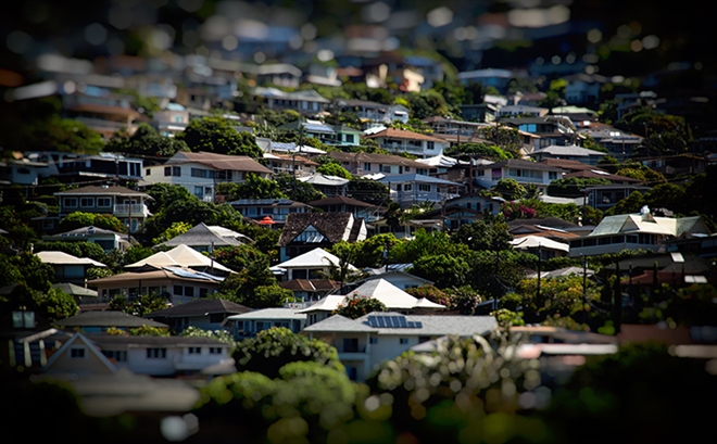
Photo credit: Johnny Silvercloud/Flickr
From pollution removal to energy savings, urban forests provide millions of dollars in environmental and economic benefit to communities across the U.S.
An increasing number of cities are leveraging open data as a way to share insights with the public about their urban forests and their work to maintain them.
Providence, Rhode Island, is one city among many that make urban forestry, tree inventory, and tree canopy data available as open data.
“It’s important to show people that trees are an investment, and it’s an appreciating asset,” says Douglas Still, the city forester for Providence, Rhode Island. “The money we spend on our forestry program reaps real value.”
A city study found Providence’s trees equated to $4.7 million in annual environmental benefits, and $8.8 million in carbon storage, based on a cost of $71 per ton.
Providence, Rhode Island, trained 100 volunteers to record address, location, tree species, tree diameter, condition, and other related information to provide a complete inventory of all the city’s trees. The details on 25,000 trees are published on the city’s open data portal.
For Providence, Still says the city uses the data internally “every day to manage our trees.”
When the city needs to issue work orders to have trees removed or pruned, or wants to track how much work has been done on which neighborhoods, the data informs a variety of decisions — including decisions on equity.
A recent National Public Radio report, which looked at data from 97 cities, found a consistent nationwide trend: low-income neighborhoods tend to be hotter than their wealthier counterparts, and they’re hotter because they have fewer trees.
“If we show you a map of a tree canopy in virtually any city in America, we’re also showing you a map of income,” said Jad Daley, president and CEO of American Forests, a nonprofit organization, according to the NPR report. “And in many cases, we’re showing you a map of race and ethnicity in ways that transcend income.”
Leaders in Providence are tuned-in to issues around social — and tree — equity. In 2007, the city mapped its tree canopy and determined that it covered about 23% of the city. Today, they’re undertaking a new urban tree canopy study using 2018 fly-over imagery, and this data will guide the city’s new master plan.
“We want there to be trees and tree cover in every neighborhood throughout the city,” Still says. “Some neighborhoods have more trees than others; that’s why we target our planting effort to the neighborhoods that need trees.”
Providence isn’t alone. Cities across the world share various urban forestry information as open data.
For example, Buffalo, New York, manages a data story, powered by Socrata Perspectives, with the Bureau of Forestry. The project gives the public easy access to details about the city’s catalog of trees, including an inventory of open and planting-appropriate spaces, the best shaded areas, and air quality benefits.
The state of Colorado publishes canopy data for the city and county of Denver that includes boundary polygons with attributes for tree canopy cover, potential tree planting spaces, and land cover classification summaries.
Melbourne, Australia, maps its tree canopy based on aerial photos and LiDAR. This map shows each of the 72,000 trees that live in Melbourne's 32 square kilometer radius. The trees are colored by how many years they have left to live, and it's obvious to even the most casual observer that a large number of the trees are in their final years. Melbourne suffered through a massive drought in the early 2000s, and the result is still being felt in the urban tree population.